Transforming Processes with BIM Collaboration
A BIM approach is essential to increase productivity and efficiency
Back in 2018, PORR made a decision to start implementing a modern BIM approach in infrastructure projects. In comparison to the building side of the business, there is a lot to do on the infrastructure projects regarding models and collaboration.
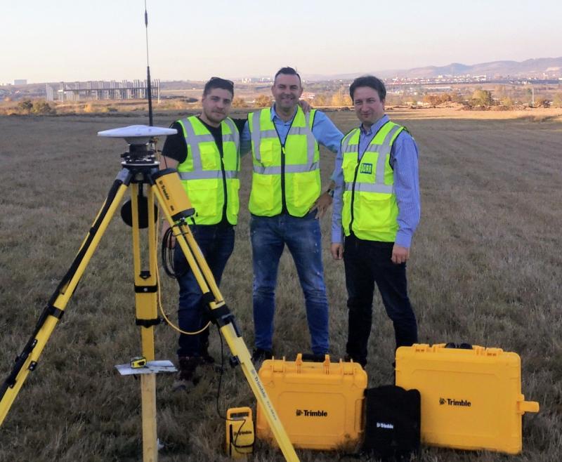
Dan Vlasceanu, originally a surveying engineer, has been working for PORR, Romania since 2019. Dan was originally employed as a survey engineer but soon went on to work with the DEEP SOIL (Digital Enduring Earthworks Performance & Survey On Intelligent Logistics) project as BIM coordinator. Dan is part of the Innovation/BIM & Design Department team supervised by Mr. Costel Cojanu. Together with his colleagues Irina Rosu and Daniel Boehnke, Dan is the driving force behind the BIM development at PORR in Romania.
The Sibiu – Boita motorway project as a platform for BIM development
The 123 km long highway from Sibiu to Pitesti is located on the Trans-European Rhine-Danube Corridor and is one of Europe's most important connections to the Black Sea. It is also the first highway that crosses the Carpathians and connects Transylvania with Wallachia, we are told by Dan Vlasceanu.
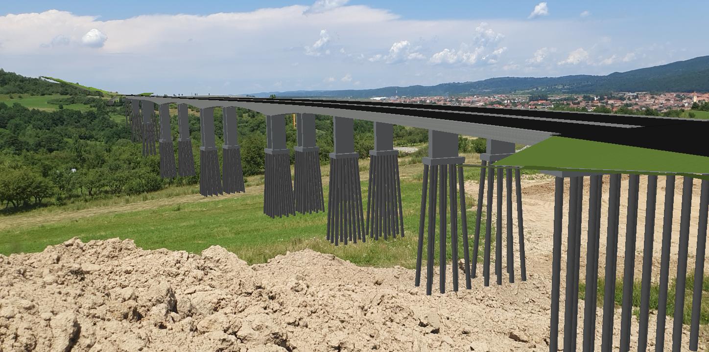
The project includes the design and construction of the four-lane section from Sibiu to Boita in the heart of Romania. PORR is constructing six bridge structures and an 8 span viaduct. In addition, two highway connections, a parking lot, and a road maintenance center will be carried out by PORR.
Based on this project, PORR is developing the DEEPSOIL Project, where a sector of 1.5km long (including one roundabout and Maintenance area) will be handled with innovative solutions as support in process planning and construction preparation with special attention to earthworks. The aim of this project is to implement all the necessary systems and technologies required to create a BIM integrated environment, for all stages of an infrastructure project.
DEEP SOIL is ongoing and the result will be presented at the beginning of 2022.
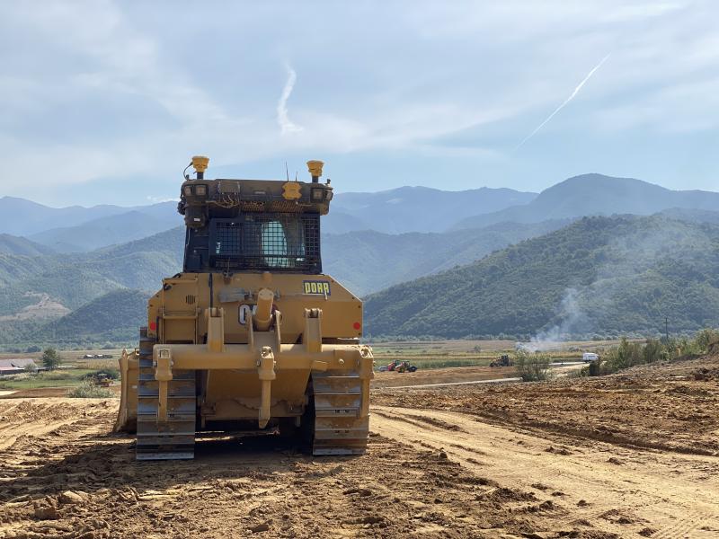
The focus of the research project is machine control, productivity management, and implementing a BIM approach. For machine control and productivity management, PORR uses Trimble hardware mounted on the machines together with Works Manager and VisionLink/Works OS on the software side. Dan, explains that there is no hesitation about the gains you got from using machine control and systems to manage the productivity for the machines.
The other part, to implement a model-based approach for the design data is a bit harder to measure. This is because the designers still work in a traditional way with most of the work aiming for drawing production and leaving a lot of work, for the contractor, to transform the drawing files to 3D models ready for further use in the field.
Before starting the project, PORR turned to SITECH Romania and Arkance Systems for help in setting up the right software and hardware environment. PORRs’ decision to use Trimble solutions was because of earlier good experience with Trimble as a provider of hardware and software. In one of the early workshops, Chris Dheere from Arkance Systems proposed Quadri, the common data environment and we decided to go for it.
Trimble Quadri, a unique BIM-platform
PORR has been using Quadri to gather all the model data in the project, both design data and as-built data from the construction site. This gives them the ability to calculate volumes, compare the theoretical design to the actual result in the field, and track progress. The ability to calculate volumes directly in the BIM platform earns a lot of time and effort. This is a feature that makes Quadri unique. "Honestly, I say that Quadri is the most complete platform I have ever seen," Dan concludes.
Dan goes on and explains the workflow in the project; First, we receive data from our designers in the form of CAD models, some in 2D and some in 3D. The most common data we receive is 3D breaklines for the top of the road, the rest is in 2D. I usually model the road in Civil 3D, because that is the design tool I know best. Then I add the road models to Quadri to use as a reference for the as-built data later on. I also add the existing terrain, orthophotos, and other basic material to the Quadri model. The modeling functions included in Quadri like triangulation of terrain, sweep, and extrude functions, are also unique features for Quadri if you compare it with other solutions.
We export the machine control files from Civil 3D and prepare them using Trimble Business Center before sending them to the machines, using WorksManager. This is a process where we could use Quadri even more integrated using the Quadri connectors both for Trimble Business Center and for Civil 3D, but that was not available when we started the project. So there is room for improvement in the next project, Dan explains.
The operators then do their work using the machine control files in the field and at the office, the surveying engineers provide them with updates using WorksManager, if the models are changed for some reason. As the machines move around they are monitored using VisionLink (now replaced by Works OS) and the machines also create data of the surfaces they produce when doing the earthmoving or building up the road body.
Integration between office and field
Every day the data produced by the machines are brought into Quadri as surfaces. This provides PORR with documentation of what is done where and how much has been produced each day. - With these surfaces, compared to the terrain surface, I easily produce a volume calculation directly in Quadri. The ability to perform volume calculations directly in the model is one of the things I appreciate the most with Quadri, Dan says.
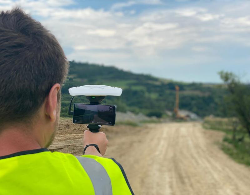
The PORR surveyors also scan the workplace regularly and add the point cloud to the Quadri model as well. All this together gives a really good picture of the progress, the volumes, and how changes inflict the project in different ways.
Dan also wants to point out the good support he has received from Arkance Systems during the whole project. Dan summarizes and says that there is a lot more he wants to do regarding new work methods and integration between office and field. Trimble SiteVision is one thing that we want to use more and integrate into our daily business because that solution is a total game-changer for the whole infrastructure business, Dan tells us.
During the conversation with Dan Vlasceanu, we also talked about the challenges in the business. We both agreed that we need more skilled people to work with the transformation of the infrastructure business. There is also a need for change in the design processes and demands from the infrastructure owners towards 3D, and model-based design.
Young people need to understand that building a road or a railway today is a hi-tech business where you use a lot of advanced tools like 3D modeling tools. To work in an infrastructure project is like playing Minecraft - for real and in a virtual world - at the same time!
The top three benefits of using Quadri according to Dan:
- Export IFC and LandXML directly from Quadri
- No other collaboration tool I have seen has the ability to contain data from different sources and mix it together and export it to other file formats.
- Volume calculation and modeling tools inside Quadri
This is an essential tool for us and makes it possible to have full control of the volumes in the project.
The feature-based model makes Quadri file format agnostic. Dan can have a mix of data from different sources, for example, road edges in IFC, DWG, and LandXML format. When he puts them into Quadri they are “just road edges and I can export them all to an IFC file for use in another software.